
The Pathfinder is best viewed using Google Earth.
To fully utilize the Pathfinder, please download the KML files here and open them in Google Earth. A KML tutorial can be found here.
Using Tim Waters' Map Warper , I was able to rectify the architectural floor plans of both the historical and current station. Using Google Earth, these can be viewed, compared, and contrasted.By rectifying the current floor plans, one can gain a better understanding of the station. The upper level can be overlayed with the lower - giving spatial context, both within the building and to the rest of the city.
To fully utilize the Pathfinder, please download the KML files here and open them in Google Earth. A KML tutorial can be found here.
Map Rectification
Using Tim Waters' Map Warper , I was able to rectify the architectural floor plans of both the historical and current station. Using Google Earth, these can be viewed, compared, and contrasted.By rectifying the current floor plans, one can gain a better understanding of the station. The upper level can be overlayed with the lower - giving spatial context, both within the building and to the rest of the city.

Once rectified, caparisons can be made between the old and the new. Below is a comparison between the 1910 street level plans and the current upper level.
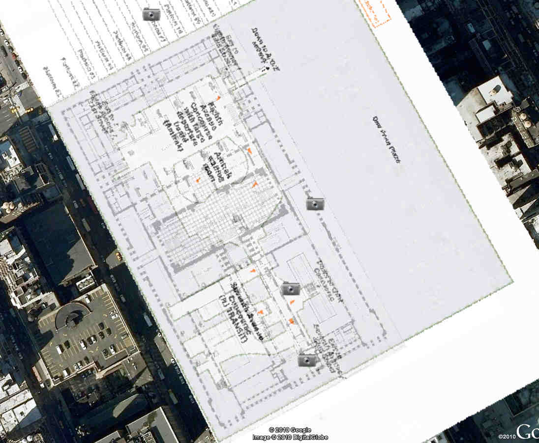
Also included in the pathfinder are historical and current images and videos. Image icons are placed near the spot where the photo would have been taken.

Forgotten NY has provided a list of surviving remnants, such as stairways, signal boxes, and other architectural elements from the original station. These have been mapped and added to the pathfinder in Google Earth.

Through rectification and comparison, remnants of the original station are revealed. A stairwell in the historic concourse and an escalator in the modern Amtrak waiting area occupy the same space.


For further context, current and historic neighborhood maps and a map of Robert Moses' planned Mid-Manhattan Expressway have also been rectified (information on these maps can be found below).